Object Status:
Unlocated
Accession Date:
September 1779
Primary Source Reference:
Du Simitière Memorandum Books, Library of Congress, fol. 45v
Additional Source Text:
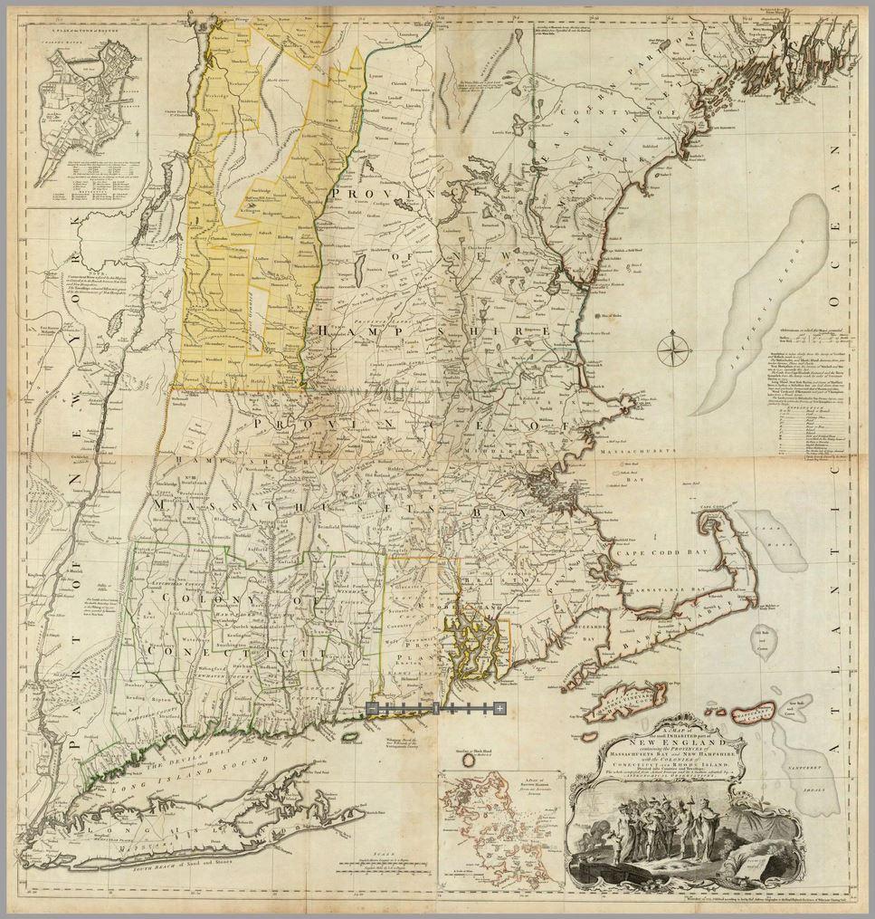
"Containing the provinces of Massachusets & New Hampshire, with the colonies of Connecticut & Rhode Island &c., in 4 sheets first published by Jefferies in 1755 & republished by T. Jefferies in 1774."
Notes:
Thomas Jefferys (d. 1771), cartographer, A Map of the Most Inhabited Part of New England Containing the Provinces of Massachusets Bay and New Hampshire, with the Colonies of Connecticut and Rhode Island, divided into Counties and Townships: The Whole Composed form Actual Surveys and Its Situation Adjusted by Astronomical Observations (London: Thos. Jefferys, 1774)
Jefferys' map, first published in 1755, went through at least six subsequent revisions, including the third edition issued in 1774 and included in the posthumously published The American Atlas: Or, A Geographical Description of the Whole Continent of America ... Engraved on Forty-Eight Copper Plates, by the Late Mr. Thomas Jefferys, Geographer to the King, and Others (London, 1776).
Du Simitière bought this copy.