Object Status:
Unlocated
Accession Date:
April 12, 1812
Primary Source Reference:
Peale Museum Accessions Book, Historical Society of Pennsylvania, p. 60
Notes:
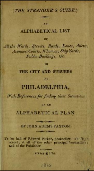
Paxton was a publisher of city directories for Philadelphia, New Orleans, and St. Louis. The pamphlet was his own new work, The Stranger's Guide. An Alphabetical List of All the Wards, Streets, Roads, Lanes, Alleys, Avenues, Courts, Wharves, Ship Yards, Public Buildings, &c. in the City and Suburbs of Philadelphia, with References for Finding Their Situations on an Alphabetical Plan (Philadelphia, 1810).
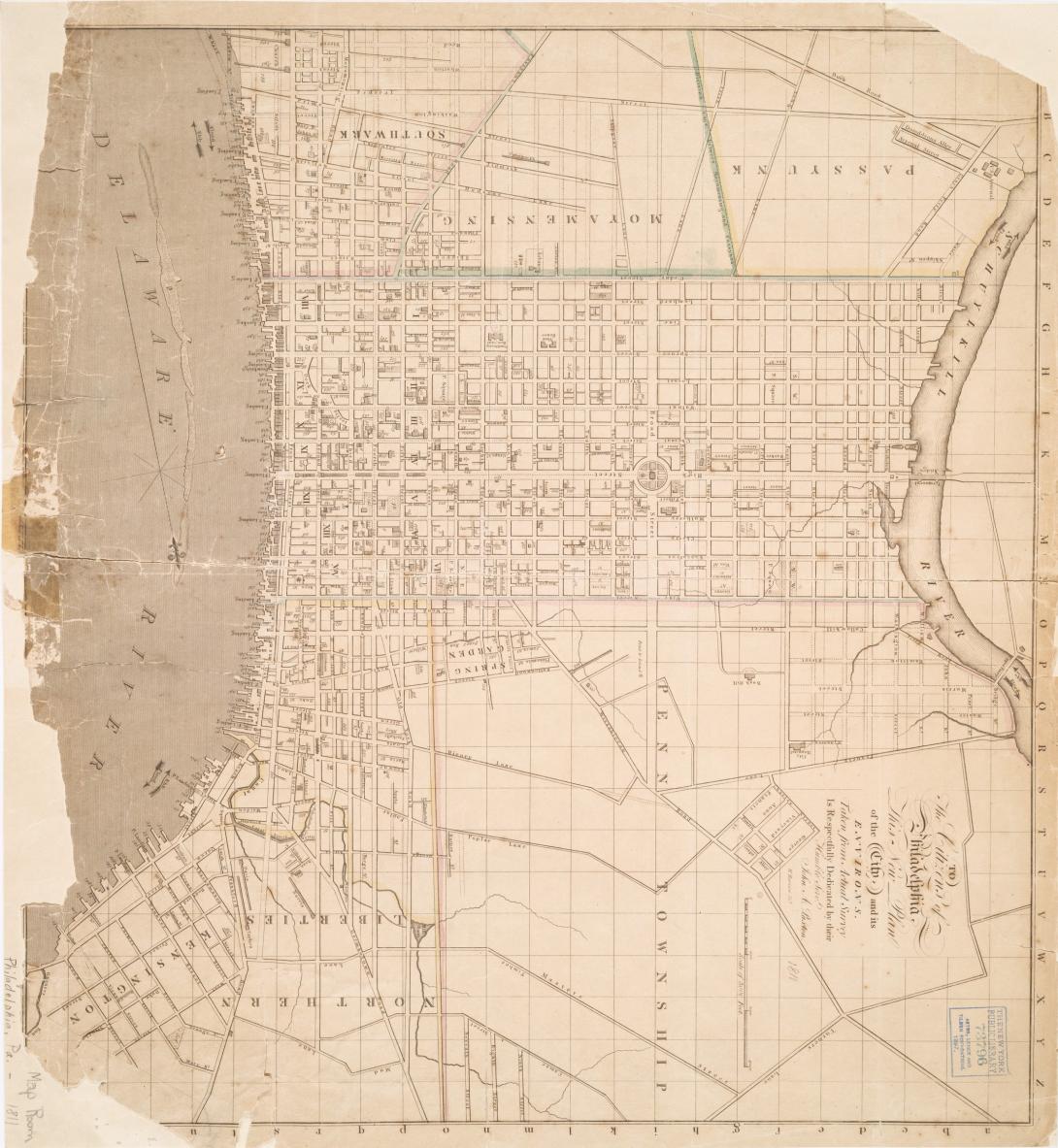
The map, also published by Adams, was To the Citizens of Philadelphia This New Plan of the City, and Its Environs. Taken from Actual Survey Is Respectfully Dedicated by Their Humble Sert. John A. Paxton [Cartographer, William Strickland (1787-1854); Engraver, W. Harrison] (Philadelphia, 1811).
Geographic Origin:
Donor:
Collection:
Date of Object:
1810